Shenandoah National Park Visitor Guide: Entrances, Skyline Drive & Trails
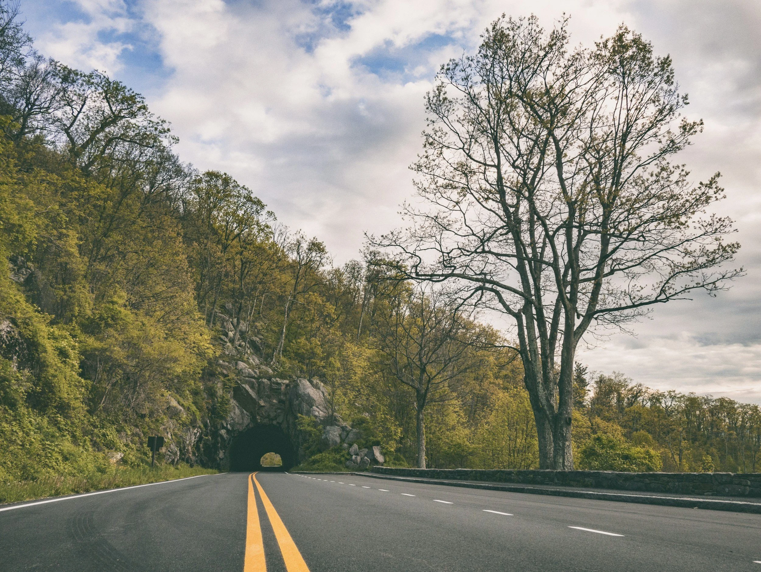
Shenandoah National Park protects nearly 200,000 acres of hardwood forests, granite summits, and tumbling hollows along the crest of Virginia's Blue Ridge Mountains. The entire length of the park connects through Skyline Drive, a 105-mile scenic roadway running from Front Royal down to Waynesboro. For travelers planning their first visit, the scale of the park can be misleading. Trying to see every overlook in a single weekend leads to hours of slow driving behind campers rather than actual time spent on mountain footpaths.
This Shenandoah National Park visitor guide breaks down how to navigate the park efficiently. By setting your home base in Luray and entering through Thornton Gap, you sit directly below the Central District, where the park's highest summits, best waterfall loops, and quietest overlooks congregate.
Here is what to know about entrance stations, pass fees, Skyline Drive mile markers, hiking permits, and where to unwind at the end of the day.
Which Shenandoah National Park entrance station should you use?
Thornton Gap at Mile 31.5 is the most practical entrance for visitors staying in Page Valley. Located on Route 211 just 15 minutes east of Luray, Thornton Gap provides immediate access to the high-elevation Central District while avoiding the heavy congestion common at the northern terminus.
The park maintains four primary entrance stations along Skyline Drive:
- Front Royal Entrance (Mile 0.0): Located off Route 340 near Interstate 66. This is the northern gateway and the primary entry point for day-trippers coming directly from northern Virginia. Weekend lines here can back up past the highway by 10 a.m.
- Thornton Gap Entrance (Mile 31.5): Located on Route 211 between Luray and Sperryville. It sits 15 minutes from Faraway Camp and delivers you directly between the North and Central Districts.
- Swift Run Gap Entrance (Mile 65.5): Located on Route 33 between Elkton and Stanardsville. This entrance serves travelers arriving from Harrisonburg, Charlottesville, or Richmond.
- Rockfish Gap Entrance (Mile 105.0): Located at the southern terminus near Waynesboro and Interstate 64, where Skyline Drive transitions directly into the Blue Ridge Parkway.
Standard park entry costs $30 per single, non-commercial vehicle and remains valid for seven consecutive days across all four gates. If you own an America the Beautiful Interagency Pass ($80) or a Shenandoah Annual Pass ($55), entry is included. Entrance booths are cashless and accept cards or mobile payments, or you can prepay digitally via recreation.gov to speed up gate processing.
Park districts and entrance overview
Shenandoah divides naturally into three management districts separated by the primary cross-mountain highways. Understanding what each section contains allows you to target your driving time:
| District & Miles | Entrance | Key Highlights | Best For |
|---|---|---|---|
| North (MP 0–31.5) | Front Royal | Dickey Ridge, Range View, Fox Hollow | Foothills, homestead ruins, valley sunsets |
| Central (MP 31.5–65.5) | Thornton Gap | Stony Man, Hawksbill, Dark Hollow, Big Meadows | 4,000 ft peaks, waterfalls, wildlife |
| South (MP 65.5–105) | Swift Run / Rockfish | Blackrock Summit, Riprap Hollow, Big Run | Talus slopes, wilderness, quiet trails |
If you have two or three days, base your exploration around the Central District. It contains the highest concentration of prominent trails and facilities, keeping your transit time to a minimum.
How does driving Skyline Drive work?
Skyline Drive spans 105 miles with a 35 mph speed limit strictly enforced throughout the park. Driving the entire highway without stopping takes roughly three and a half hours, but with wildlife crossings, cyclists, and overlook turnouts, expect a full-length transit to take closer to five hours.
Mileposts are marked with small concrete posts on the west side of the road, counting up from Mile 0 at Front Royal to Mile 105 at Rockfish Gap. All trailheads, picnic grounds, campgrounds, and waysides use these mile markers as their official addresses.
Seventy-five designated overlooks line the ridge. East-facing overlooks catch the morning sun breaking over the Piedmont, while west-facing pulloffs look across Page Valley toward Massanutten Mountain. Four overlooks stand out for exceptional scenery:
- Range View Overlook (Mile 17.1): One of the widest vistas in the North District, looking south down the spine of the Blue Ridge.
- Pinnacles Overlook (Mile 35.1): A steep view across the upper Piedmont toward Old Rag and Robertson Mountain.
- Stony Man Overlook (Mile 38.6): Sweeping view west across Page Valley and Luray toward Massanutten Mountain.
- Thorofare Mountain Overlook (Mile 40.5): Deep wilderness perspective across unbroken forest canopy to the east, with a clear profile view of the Stony Man cliffs.
If you plan to visit during peak color season, consult our Shenandoah fall foliage guide for breakdown by elevation bands and traffic strategies.
Cellular service is notoriously unreliable along the drive. Download offline maps and trail guides to your phone before driving up the mountain from Luray.
Which day hikes should first-time visitors prioritize?
Shenandoah contains over 500 miles of hiking trails, including 101 miles of the Appalachian Trail. First-time visitors should focus on a balance of open summit panoramas and shaded creek gorges in the Central District.
For a detailed side-by-side breakdown of trail terrain, elevation profiles, and parking logistics, read our Shenandoah hike comparison. Here is the quick selection:
- Stony Man Trail (Mile 41.7): 1.6 miles round trip. Moderate climb through birch forests leading to a sweeping cliff edge at 4,011 feet elevation. Accessible for most fitness levels.
- Hawksbill Summit Loop (Mile 45.5): 2.9 miles. Reaches the highest point in Shenandoah National Park at 4,051 feet, with a stone observation platform and 360-degree mountain views.
- Rose River Loop (Mile 49.4): 4.0 miles. A shaded circuit tracing cascading mountain streams, gravel pools, and the 67-foot drop of Rose River Falls.
- Old Rag Mountain (Boundary Trailhead via Nethers): 9.4 miles. The park's signature strenuous rock scramble. Day-use tickets are required from March 1 through November 30. Tickets cost $2 on recreation.gov and are capped at 800 per day: 400 release 30 days in advance and 400 release five days out at 10 a.m. ET.
Shenandoah is exceptionally welcoming to pets. Read our dog-friendly Shenandoah guide to learn which 480+ trail miles allow leashed dogs and which specific trails ban them.
Where do you eat, drink, and refill supplies?
Commercial services inside Shenandoah National Park are seasonal and clustered at designated developed areas. Skyland (Mile 41.7 and 42.5) and Big Meadows (Mile 51.2) provide sit-down dining rooms and grab-and-go taprooms. Waysides at Elkwallow (Mile 24.1), Big Meadows, and Loft Mountain (Mile 79.5) stock camp groceries and run short-order grills serving blackberry ice cream. Big Meadows Wayside operates the only gas pumps inside the park.
During summer and fall weekends, in-park dining venues face lengthy wait times. A better strategy is packing trail lunches in your daypack, then descending into Luray for dinner and craft beverages.
Downtown Luray sits 15 minutes down Route 211 from the Thornton Gap entrance. You can pick up fresh pastries and espresso at Gathering Grounds, book dinner at Watch and Warrant, or drive 15 minutes to Stanley for local pours at Coal Ridge Brewery. To spend an afternoon touring regional wineries, cideries, and distilleries, follow our Blue Ridge Whisky Wine Loop guide across Page and Rappahannock counties.
For a full 48-hour itinerary covering trail timing, dinner reservations, and scenic detours, review our weekend trip from DC.
Where should you stay when visiting Shenandoah?
Traditional park lodges at Skyland and Big Meadows book up many months in advance with modest hotel-style rooms. Standard valley chain motels put you on busy commercial strips far removed from the wilderness atmosphere.
Faraway Camp is built around a different model: a private luxury basecamp on 50 mountain acres in Luray, Virginia, 15 minutes from the Thornton Gap entrance. Guests stay in custom geodesic domes designed around physical contrast: spend the morning navigating red-clay footpaths, loose granite talus, and brisk 50-degree ridge winds, then return to a heated 72-degree dome interior with a walk-in tile shower and plush King DreamCloud bed.
Each dome includes high-speed Starlink WiFi, a modern kitchenette with quartz counters, full climate control, an outdoor propane grill, and an expansive private deck with a fire pit overlooking a quiet pond. As a premier destination for glamping in Virginia, Faraway gives you direct access to the national park while preserving complete evening privacy.
Quick FAQ
How much does it cost to enter Shenandoah National Park?
Standard private vehicle entry is $30, valid for seven consecutive days across all entrance stations. America the Beautiful interagency annual passes ($80) and Shenandoah annual passes ($55) are accepted.
What is the closest park entrance to Luray and Faraway Camp?
The Thornton Gap Entrance Station at Mile 31.5 on Route 211 is the closest gate, located 15 minutes east of Luray and Faraway Camp.
Do you need reservations to enter Shenandoah National Park?
No general timed-entry reservation is required to drive Skyline Drive or enter the park. Old Rag Mountain requires a separate $2 day-use ticket per person from March 1 through November 30, booked on recreation.gov.
How long does it take to drive Skyline Drive?
Driving the entire 105 miles at the 35 mph speed limit takes about three and a half hours without stopping. Driving the popular Central District between Thornton Gap and Swift Run Gap takes about one hour.
Are dogs allowed on hiking trails in Shenandoah?
Yes. Leashed dogs are permitted on over 480 of the park's 500 trail miles. Only a few specific routes with steep rock scrambles, including Old Rag and upper Stony Man summit, prohibit pets.
Ready to plan your Shenandoah basecamp? Check Faraway availability →